Most linked-to files
Showing below up to 50 results in range #1,151 to #1,200.
View (previous 50 | next 50) (20 | 50 | 100 | 250 | 500)
- Map of Arkansas NA.png
- Cactus Patch Y.jpg
- Location map Spain Tenerife.png
- Baja Verapaz in Guatemala.svg
- Reliefkarte Luzern blank.png
- North Atlantic Ocean laea relief location map.jpg

- IndonesiaBali.png
- Oceania laea location map.svg
- Afghanistan-CIA WFB Map.png


- Old Kanavino Nizhny Novgorod.png
- Tanzania-CIA WFB Map.png
- Juan de Fuca unmarked.png
- Mediterranean Sea East location map.svg
- Cb-map.png

- Map of Pennsylvania NA.png

- Eaton Chapel.jpg
- Locator map AZO FLO Lajes.svg
- Bangkok Metropolitan Region.svg
- Full Star Yellow.svg
- Cg-map.png
- Lafayette, Louisiana.png
- Reliefkarte Waadt blank.png
- Adams' Burial Site 002.jpg

- Ghana-CIA WFB Map.png
- South Atlantic Ocean laea relief location map.jpg
- IndonesiaJambi.png
- Maldives-CIA WFB Map.png
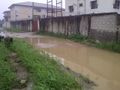 New Nation Close, Mgbuoba Port Harcourt before construction by Charles Dukwe.jpg Used on 2 pages
1,280 × 959; 209 KB
- Belgium-CIA WFB Map.png


.jpg)
_(promo)_01.jpg)


)_(P_(R))_%3D_(P_(Q_R))_2-2-6_ISW.jpg)


(Q,dQ),PQ).jpg)


).jpg)